发表论文
2022
Yang, K., Smith, L. C., Andrews, L. C., Fettweis, X., & Li, M., Supraglacial drainage efficiency of the Greenland Ice Sheet estimated from remote sensing and climate models. Journal of Geophysical Research: Earth Surface, 2022.
Li, Y., Yang, K.*, Gao, S., Smith, L.C., Fettweis, X., &Li, M., Surface meltwater runoff routing through a coupled supraglacial-proglacial drainage system, Inglefield Land, northwest Greenland. International Journal of Applied Earth Observation and Geoinformation, 2022.
Mao, W., Yang, K.*, Zhang, W., Wang Y. & Li, M., High-resolution global water body datasets underestimate the extent of small rivers. International Journal of Remote Sensing, 2022.
梁相安,张闻松,李雅,陆瑶,杨康*.南极半岛巴赫冰架冰面融水动态遥感监测.极地研究, 2022.
2021
Yang, K., Smith, L.C., Cooper, M.G., Pitcher, L.H., van As, D., Lu, Y., Lu, X., Li, M.: Seasonal evolution of supraglacial lakes and rivers on the southwest Greenland Ice Sheet. Journal of Glaciology, 2021.
Lu, Y., Yang, K.*, Lu, X., Li, Y., Gao, S., Mao, W., Li, M., 2021. Response of supraglacial rivers and lakes to ice flow and surface melt on the northeast Greenland Ice Sheet during the 2017 melt season. Journal of Hydrology, 2021.
Lu, X., Yang, K.*, Bennett, M.M., Liu, C., Mao, W., Li, Y., Zhang, W., Li, M., 2021. High-resolution satellite-derived river network map reveals small Arctic river hydrography. Environmental Research Letters, 2021.
Gleason, C. J., Yang, K., Feng, D., Smith, L. C., Liu, K., Pitcher, L. H., Chu, V. W., Cooper, M. G., Overstreet, B. T., Rennermalm, A. K., and Ryan, J. C.: Hourly surface meltwater routing for a Greenlandic supraglacial catchment across hillslopes and through a dense topological channel network, The Cryosphere, 2021.
章斯腾, 陆欣, 陆瑶, 程亮, 李满春, 杨康*.青藏高原河流网络高分CubeSat遥感监测.遥感学报,2021.
毛玮, 陆欣, 陆瑶, 杨康*. 基于地形指数的格陵兰冰面水系建模与评价. 极地研究. 2021.
2020
Yang, K., Sommers, A., Andrews, L. C., Smith, L. C., Lu, X., Fettweis, X., and Li, M.: Inter-comparison of surface meltwater routing models for the Greenland Ice Sheet and influence on subglacial effective pressures, The Cryosphere, 2020.
Liu, C., Yang, K.*, Bennett, M.M., Lu, X., Guo, Z., Li, M.: Changes to anthropogenic pressures on reach-scale rivers in South and Southeast Asia from 1990 to 2014, Environmental Research Letters, 2020.
Lu, X., Yang, K.*, Gleason, C.J., Smith, L.C., Li, M.: Small Arctic rivers mapped from Sentinel-2 satellite imagery and ArcticDEM, Journal of Hydrology, 584, 2020.
Gao,S., Yang, K.*, Lu,Y., Lu, X. and Li, M.: Measuring Ice Flow Velocity on the Greenland Ice Sheet Using Stable Supraglacial River, in IEEE Geoscience and Remote Sensing Letters, 2020.
Lu, Y., Yang, K.*, Lu, X., Smith, L.C., Sole, A.J., Livingstone, S.J., Fettweis, X., and Li, M.: Diverse supraglacial drainage patterns on the Devon Ice Cap, Arctic Canada, Journal of Maps, 2020.
Guo, Z., Yang, K.*, Liu, C., Lu, X., Cheng, L., and Li, M.: Mapping National-Scale Croplands in Pakistan by Combining Dynamic Time Warping Algorithm and Density-Based Spatial Clustering of Applications with Noise, Remote Sensing, 2020.
Gleason, C. J., Yang, K., Feng, D., Smith, L. C., Liu, K., Pitcher, L. H., Chu, V. W., Cooper, M. G., Overstreet, B. T., Rennermalm, A. K., and Ryan, J. C.: Hourly surface meltwater routing for a Greenlandic supraglacial catchment across hillslopes and through a dense topological channel network, The Cryosphere Discuss., 2020.
Bennett, M.M., Stephenson, S.R., Yang, K., Bravo, M.T., De Jonghe, B. The opening of the Transpolar Sea Route: Logistical, geopolitical, environmental, and socioeconomic impacts. Marine Policy. 104178, 2020.
李雅,陆瑶,陆欣,李满春,杨康*.西北格陵兰冰盖英格尔菲尔德地区冰面-冰前流域水系遥感监测[J].极地研究,2020,32(03):314-321.
郭紫燕,杨康*,刘畅,程亮,李满春.巴基斯坦土地覆盖数据产品季节性精度评价[J].遥感技术与应用,2020,35(03):567-575.
2019
Yang, K., Smith, L. C., Fettweis, X., Gleason, C. J., Lu, Y., and Li, M.: Surface meltwater runoff on the Greenland ice sheet estimated from remotely sensed supraglacial lake infilling rate, Remote Sensing of Environment, 234, 111459, 2019.
Yang, K., Smith, L.C., Sole, A., Livingstone, S.J., Cheng, X., Chen, Z., Li, M., 2019. Supraglacial rivers on the northwest Greenland Ice Sheet, Devon Ice Cap, and Barnes Ice Cap mapped using Sentinel-2 imagery. International Journal of Applied Earth Observation and Geoinformation 78, 1-13.
Liu, C., Yang, K.*, Bennett, M.M., Guo, Z., Cheng, L., Li, M. Automated Extraction of Built-Up Areas by Fusing VIIRS Nighttime Lights and Landsat-8 Data. Remote Sens. 2019,11, 1571.
2018
Yang, K., Smith, L.C., Karlstrom, L., Cooper, M.G., Tedesco, M., As, D.v., Cheng, X., Chen, Z., Li, M., 2018. A new surface meltwater routing model for use on the Greenland Ice Sheet surface. Cryosph. 12, 3791-3811.
Crozier, J., Karlstrom, L., Yang, K., 2018. Basal control of supraglacial meltwater catchments on the Greenland Ice Sheet. Cryosph. 12, 3383-3407.
Cooper, M.G., Smith, L.C., Rennermalm, A.K., Miège, C., Pitcher, L.H., Ryan, J.C., Yang, K., Cooley, S., 2018. Meltwater storage in low-density near-surface bare ice in the Greenland ice sheet ablation zone. Cryosph. 12, 955-970.
Ignéczi, Á., Sole, A.J., Livingstone, S.J., Ng, F.S., Yang, K., 2018. Greenland Ice Sheet surface topography and drainage structure controlled by the transfer of basal variability. Front. Earth Sci. 6, 101.
Cheng, L., Yuan, Y., Xia, N., Chen, S., Chen, Y., Yang, K., Ma, L., Li, M., 2018. Crowd-sourced pictures geo-localization method based on street view images and 3D reconstruction. ISPRS Journal of Photogrammetry and Remote Sensing 141, 72-85.
Deng, S., Cheng, L., Yang, K., Chen, Y., Gao, Y., Yang, N., Li, M., 2018. A multi-scalar evaluation of differential impacts of canonical ENSO and ENSO Modoki on drought in China. International Journal of Climatology, 1-20.
2017
Smith, L.C., Yang, K.(共同一作), Pitcher, L.H., Overstreet B.T., Chu, V.W., Rennermalm, A.K., Ryan, J., Cooper, M.G., et al, 2017. Direct measurements of meltwater runoff on the Greenland ice sheet surface. Proceedings of the National Academy of Sciences (PNAS), 114(50): E10622–E10631 (PNAS封面文章).
Yang, K., Karlstrom, L., Smith, L.C., Li, M., 2017. Automated high resolution satellite image registration using supraglacial rivers on the Greenland Ice Sheet. IEEE Journal of Selected Topics in Applied Earth Observations and Remote Sensing, 10(3): 845-856.
2016
Yang, K., Smith, L.C., 2016. Internally drained catchments dominate supraglacial hydrology of the southwest Greenland Ice Sheet. Journal of Geophysical Research: Earth Surface, 121: 1891-1910.
Yang, K., Smith, L.C., Chu, V.W., Pitcher, L.H., Gleason, C.J., Rennermalm, A.K., Li, M., 2016. Fluvial morphometry of supraglacial river networks on the southwest Greenland Ice Sheet. GIScience & Remote Sensing, 53(4): 459-482.
Karlstrom, L. and Yang, K., 2016. Fluvial supraglacial landscape evolution on the Greenland Ice Sheet. Geophysical Research Letters, 43: 2683–2692.
Pitcher, L.H, Smith, L.C., Gleason, C.J., Yang, K., 2016. CryoSheds: a GIS Modeling Framework for Generating Hydrologic Watersheds for land-terminating glaciers and ice sheets using Digital Elevation Models and Remote Sensing Observations. GIScience and Remote Sensing, 53(6): 707-722.
Gleason, C.J., Smith, L.C., Chu, V.W., Legleiter, C.J., Pitcher, L.H., Overstreet, B.T., Rennermalm, A.K., Forster, R.R., Yang, K., 2016. Characterizing supraglacial meltwater channel hydraulics on the Greenland Ice Sheet from in situ observations. Earth Surface Processes and Landforms, 41(14): 2111-2122.
King, L., Hassan, M., Yang, K., Flowers, G., 2016. Flow routing for delineating supraglacial meltwater channel networks. Remote Sensing, 8(12): 988.
杨康, 刘巧, 2016. 冰川表面水文系统研究综述. 冰川冻土, 38(6): 1666-1678.
2015
Smith, L.C., Chu, V.W., Yang, K., Gleason, C.J., Pitcher, L.H., Rennermalm, A.K., Legleiter, C.J., Behar, A.E., Overstreet, B.T., Moustafa, S.E., Tedesco, M., Forster, R.R., LeWinter, A.L., Finnegan, D.C., Sheng, Y., Balog, J., 2015. Efficient meltwater drainage through supraglacial streams and rivers on the southwest Greenland ice sheet. Proceedings of the National Academy of Sciences (PNAS), 112(4): 1001-1006 (PNAS封面文章).
Yang, K., Li, M., Liu, Y., Cheng, L., Huang, Q., Chen, Y., 2015. River Detection in Remotely Sensed Imagery Using Gabor Filtering and Path Opening. Remote Sensing, 7(7): 8779-8802.
Yang, K., Smith, L.C., Chu, V.W., Gleason, C.J., Li, M., 2015. A Caution on the Use of Surface Digital Elevation Models to Simulate Supraglacial Hydrology of the Greenland Ice Sheet. IEEE Journal of Selected Topics in Applied Earth Observations and Remote Sensing, 8(11): 5212-5224.
Liu, Y., Zhou, M., Zhao, S., Zhan, W., Yang, K., Li, M, 2015. Automated extraction of tidal creeks from airborne laser altimetry data. Journal of Hydrology, 527: 1006-1020.
Wang, Y., Zhao, F., Cheng, L., Yang, K., 2015. Framework for monitoring the conversion of cultivated land to construction land using SAR image time series. Remote Sensing Letters 6, 794-803.
2014
Yang, K., Li, M., Liu, Y., Cheng, L., Duan, Y., Zhou, M., 2014. River Delineation from Remotely Sensed Imagery Using a Multi-Scale Classification Approach. IEEE Journal of Selected Topics in Applied Earth Observations and Remote Sensing, 7(12): 4726-4737.
Yang, K., Li, M., 2014. Greenland Ice Sheet surface melt: A review. Sciences in Cold and Arid Regions, 6(2): 99-106.
Chen, Y., Cheng, L., Li, M., Wang, J., Tong, L., Yang, K., 2014. Multiscale grid method for detection and reconstruction of building roofs from airborne LiDAR data. IEEE Journal of Selected Topics in Applied Earth Observations and Remote Sensing 7, 4081-4094.
2013
Yang, K., Smith, L.C., 2013. Supraglacial streams on the Greenland ice sheet delineated from combined spectral-shape information in high-resolution satellite imagery. IEEE Geoscience and Remote Sensing Letters, 10(4): 801-805.
Cheng, L., Yang, K., Tong, L., Liu, Y., Li, M., 2013. Invariant triangle-based stationary oil platform detection from multi-temporal synthetic aperture radar data. Journal of Applied Remote Sensing, 7.
Liu, Y., Li, M., Zhou, M., Yang, K., Mao, L., 2013. Quantitative Analysis of the Waterline Method for Topographical Mapping of Tidal Flats: A Case Study in the Dongsha Sandbank, China. Remote Sensing 5, 6138.
杨康, 2013. 格陵兰冰盖表面消融研究进展. 冰川冻土, 35(1): 101-109.
Before 2013
杨康, 李满春, 刘永学, 程亮, 陈焱明, 2012. 基于累积相似度表面的空间权重矩阵构建方法. 测绘学报, 41(2): 259-265.
杨康, 李满春, 刘永学, 程亮, 江冲亚, 2011. 遥感影像道路的多点同时快速行进提取方法. 遥感技术与应用, 26(3): 294-302.


参加学术会议
[1] 特邀报告Yang, K., 2016. Supraglacial river networks on the southwest Greenland Ice Sheet. Greenland Ice Sheet Hydrology, Topography and Dynamics Workshop, University of Sheffield, Sheffield, United Kingdom.
[2] 特邀报告Yang, K., 2016. Understanding Greenland Supraglacial Hydrology Using a Remotely Sensed Approach. Geography Department, University of Sheffield, Sheffield, United Kingdom.
[3] 特邀报告Yang, K., 2016. Surface meltwater routing on the Greenland Ice Sheet. Department of Earth Sciences, University of Oregon, Eugene, Oregon.
[4] 特邀报告Yang, K., 2016. Mapping Arctic rivers using PGC high-resolution satellite images. Polar Cyberinfrastructure Research Coordination Network Cyber + Imagery Workshop, Polar Geospatial Center, University of Minnesota, St. Paul, Minnesota, USA.
[5] Yang, K., Smith, L.C., Pitcher, L.H., 2016. Internally drained catchments dominate supraglacial hydrology of the southwest Greenland Ice Sheet. Greenland Surface Mass Balance Workshop, Lamont–Doherty Earth Observatory of Columbia University, New York City, New York, USA.
[6] Yang, K. and Smith, L.C., 2016. Internally drained catchments dominate supraglacial hydrology of the southwest Greenland Ice Sheet. Fall Meeting of the American Geophysical Union, San Francisco, California, USA.
[7] Yang, K., 2015. Monitoring supraglacial hydrologic features on the southwest Greenland Ice Sheet using Landsat-8 panchromatic imagery. Arctic Observing Open Science Meeting, Seattle, Washington, USA.
[8] Yang, K., Smith, L.C., Chu, V.W., Pitcher, L.H., Gleason, C.J., 2015. Internally Drained Supraglacial River Catchments on the Southwest Greenland Ice Sheet. Fall Meeting of the American Geophysical Union, San Francisco, California, USA.
[9] Yang, K. and Smith, L.C., 2012. Supraglacial Rivers on the Greenland Ice Sheet Delineated from Combined Spectral-Shape Information in High Resolution WorldView-2 Satellite Imagery. Fall Meeting of the American Geophysical Union, San Francisco, California, USA.
[10] Yang, K., 2010. Multi-points Fast Marching: A Novel Method for Road Extraction. The 18th International Conference on Geoinformatics, Beijing, China.
[11] Yang, K., 2009. Urban air pollution study based on GIS. 2009 Joint Urban Remote Sensing Event, Shanghai, China.
授权国家发明专利
[1] 一种海岸带水体遥感信息全自动提取方法 (ZL201010566910.8).
[2] 基于区域聚类的遥感影像分割方法 (ZL201010566893.8).
[3] 基于半监督学习的海岸海洋遥感特征地类识别方法 (ZL201010568737.5).
[4] 一种基于恒虚警率的影像舰船提取方法 (ZL201010568736.0).
[5] 一种利用多时相雷达数据检测海上静止目标的方法 (ZL201210275677.7).
[6] 一种基于LiDAR数据与正射影像的3维屋顶重建方法 (ZL201110423560.4).
[7] 一种基于LiDAR数据的建筑物区域提取方法 (ZL201110432421.8).
[8] 基于多分辨率遥感影像离散点融合的DEM构建方法 (ZL201110417845.7).
登记软件著作权
[1] 海岸海洋专题信息遥感提取与反演系统软件 (2011SR012715).
[2] 海岸海洋环境与资源遥感监测与评价分析系统软件 (2011SR012682).
媒体报道
新华社,“中外科学家团队发现:格陵兰冰盖冰面融水量被高估”(2018年1月11日)
//www.xinhuanet.com/tech/2018-01/11/c_1122245351.htm
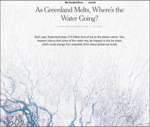
New York Times, As Greenland melts, where's the water going? (December 5, 2017).
//www.nytimes.com/interactive/2017/12/05/climate/greenland-ice-melting.html
National Geographic, “Mapping the Hidden Worlds Beneath Greenland’s Ice” (August 4, 2016).
Futurity, “Like rivers on land, melting water erodes Greenland’s ice” (April 6, 2016).
Phys.org, Eurasia Review, Newswise, Science News, and ScienceDaily, “Summer melt-driven streams on Greenland's ice sheet brought into focus” (April 5, 2016).
New York Times, “Greenland is melting away” (October 28, 2015,纽约时报头版头条)
//www.nytimes.com/interactive/2015/10/27/world/greenland-is-melting-away.html
